|
|
573-858-9225 • Eminence, Missouri
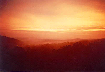
Views & Scenery
Click here to view a sampling of the beautiful views and scenery you can experience near Round Spring Retreat.
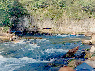
The Ozark National Scenic Riverways runs through Eminence and is home to two of the most beautiful waterways in the state: the Current and Jacks Fork rivers. Following is a description:
Current River
The Current River begins in Montauk State Park located in the southwestern corner of Dent County in southeastern Missouri. The confluence of Pigeon Creek and Montauk Spring form the headwaters of the river. Montauk Spring makes up most of the consistent flow of the headwaters, providing ideal conditions for trout fishing.
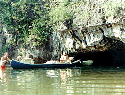
After leaving Montauk State Park the river enters the Ozark National Scenic Riverways. The uppermost reaches of the river are swift with numerous riffles broken by deep pools of crystal clear water, further downstream the riffles continue but get further apart. Hardwood trees, rock ledges, caves, springs, gravel bars, and towering limestone bluffs line the banks of the river.
Welch Spring, a first magnitude spring, enters the river approximately 14 miles (23 km) downstream from the headwaters, nearly doubling the flow of the river. Other notable springs to add to the river include Cave Spring, Pulltite Spring, and Round Spring. Downstream from the headwaters approximately 52 miles (84 km) the Current River receives its largest tributary, the Jacks Fork, from the west near the small town of Eminence, Missouri.
Blue Spring, another first magnitude spring, empties into the river, 9 miles (14 km) downstream from the confluence with the Jacks Fork. The Current River is approximately 86 miles (138 km) long when it passes by the town of Van Buren, Missouri and under U.S. Highway 60. South of Van Buren a few miles the Current River receives its second biggest tributary, the largest spring in the Ozarks and one of the largest single spring outlets known in the world. Big Spring empties into the river providing nearly 470 cubic feet (13 m3) of water per second.[5] From Big Spring the river continues southeasterly leaving the Ozark National Scenic Riverways 105 miles (169 km) from the headwaters.
The river then flows through Mark Twain National Forest until reaching Doniphan, Missouri and passes under U.S. Highway 160. From here the river slows as it exits the Ozark Highlands, the river continues its slow silt laden path into Arkansas where it receives the Little Black River from the northeast before it joins the Black River near Pocahontas, Arkansas.
Canoeing, fishing, horseback riding, and camping are very popular activities along the Current River. The river is fairly gentle and is considered to have mostly class 1 rapids, and a couple class 2.
Some of the points of interest along the course of the river include Montauk State Park (trout park), Welch Spring and abandon hospital, Aker's Ferry, Cave Spring, Devil's Well, Deer Leap, Rock House Cave, Pulltite Spring, Round Spring, Jacks Fork, Blue Spring, Rocky Falls (on a small tributary), and Big Spring.
Jacks Fork River
Jacks Fork is one of two rivers in Missouri that are part of the Ozark National Scenic Riverways system.
Starting in Texas County, Missouri, this spring-fed river flows 46.4 miles (74.7 km) in a general east to northeasterly direction through the heart of the geological area known as the Lower Ozark Natural Division. It is the major tributary of the Current River, ending at its confluence near Eminence, Missouri.
The first 25 miles (40 km) from the Prongs to Bay Creek is deep valley and in the springtime provides Class II water. Due to lack of access, it is the most primitive of the rivers in the region. From Alley Spring to its confluence with the Current River it is a Class I River and is floatable year around with warm water.
The Jacks Fork provides some of the most natural conditions in the region with many caves and natural springs. It is a popular recreation destination for canoeists and kayakers and is generally considered a Class I-II difficulty river.
The river is mentioned in the lyrics of the Greg Brown song "Walkin' Daddy" on the album Covenant.
|